
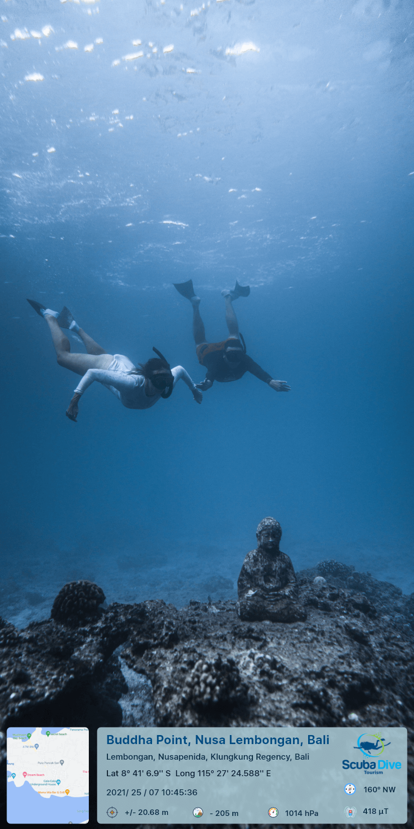
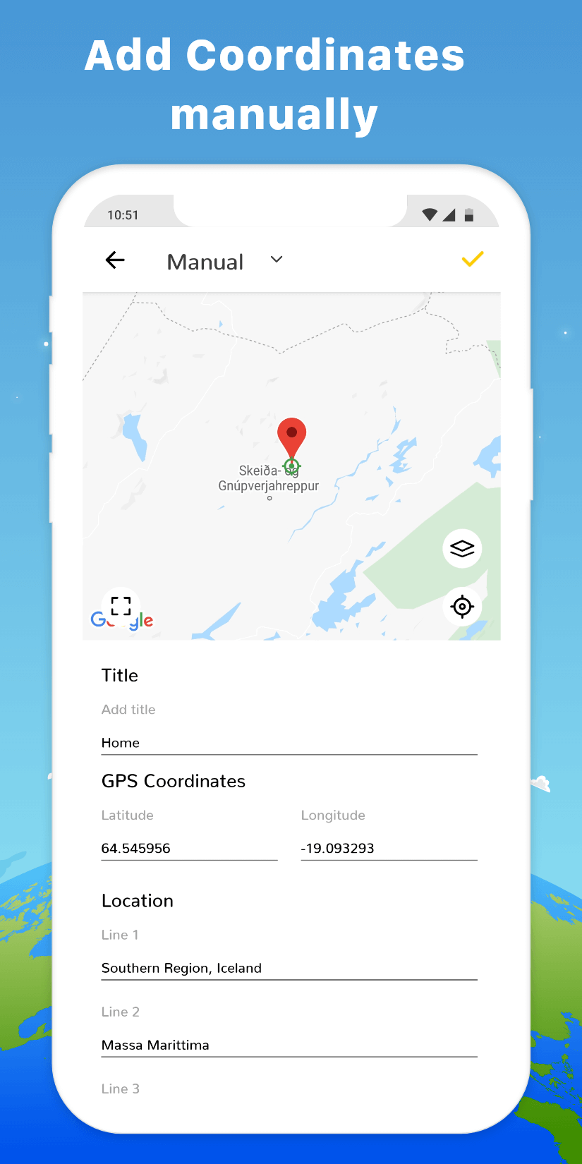
The GPS Map Camera MOD APK provides access to the premium features of the application, removing the limitations usually found in the standard release. This version allows users to utilize all available templates and data stamping options that are typically locked behind a paywall.
What’s Modified in GPS Map Camera
- Premium Unlocked: All premium features and tools within the application are available for use.
This GPS Map Camera MOD APK build is version 1.9.29 with a file size of 14.93 MB and an unknown package name; it is a re-signed file that cannot be installed over an existing copy from the store.
About GPS Map Camera
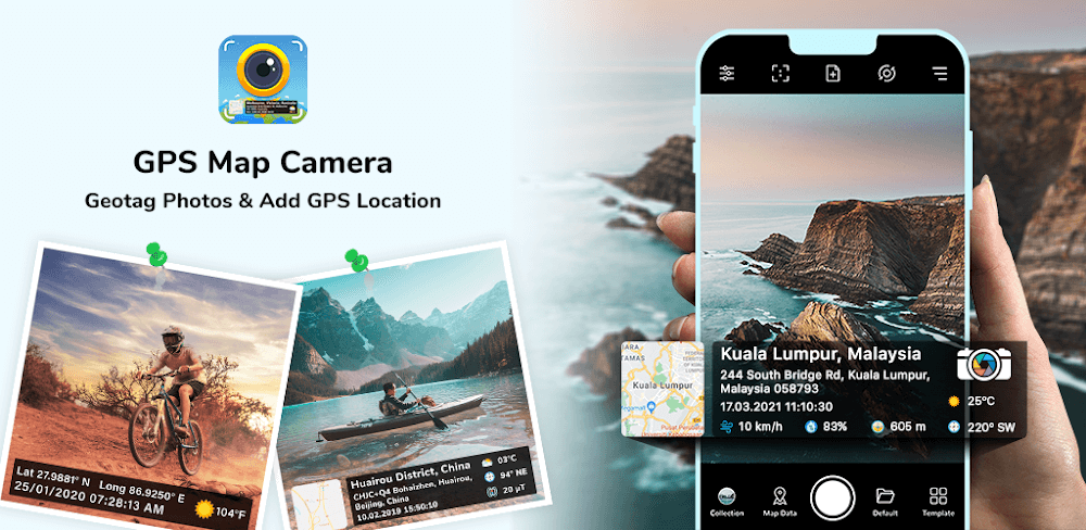
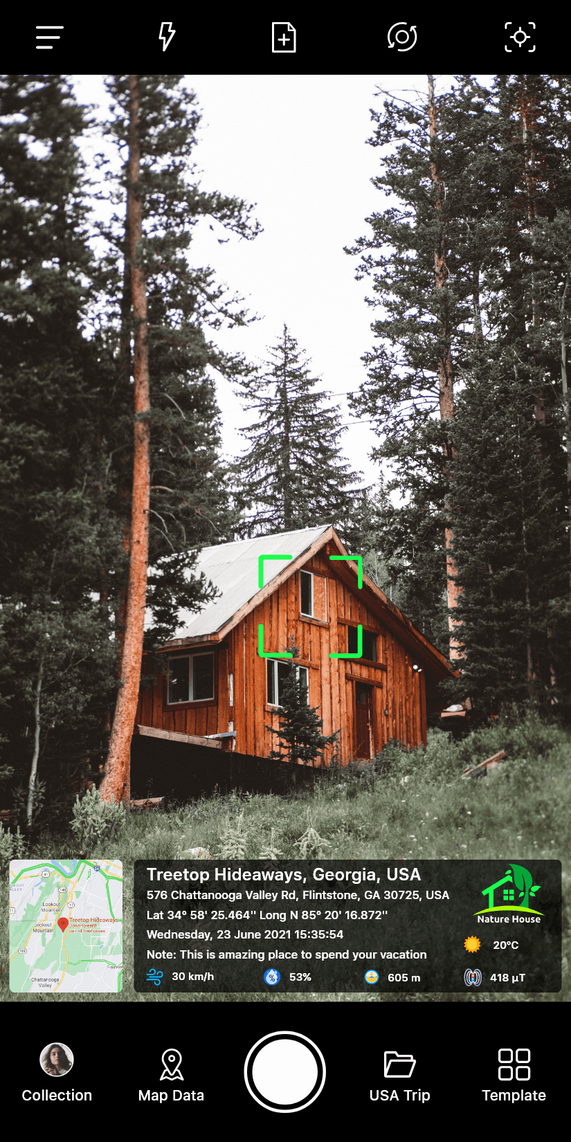
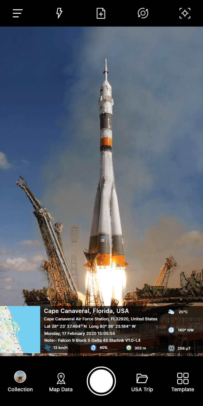
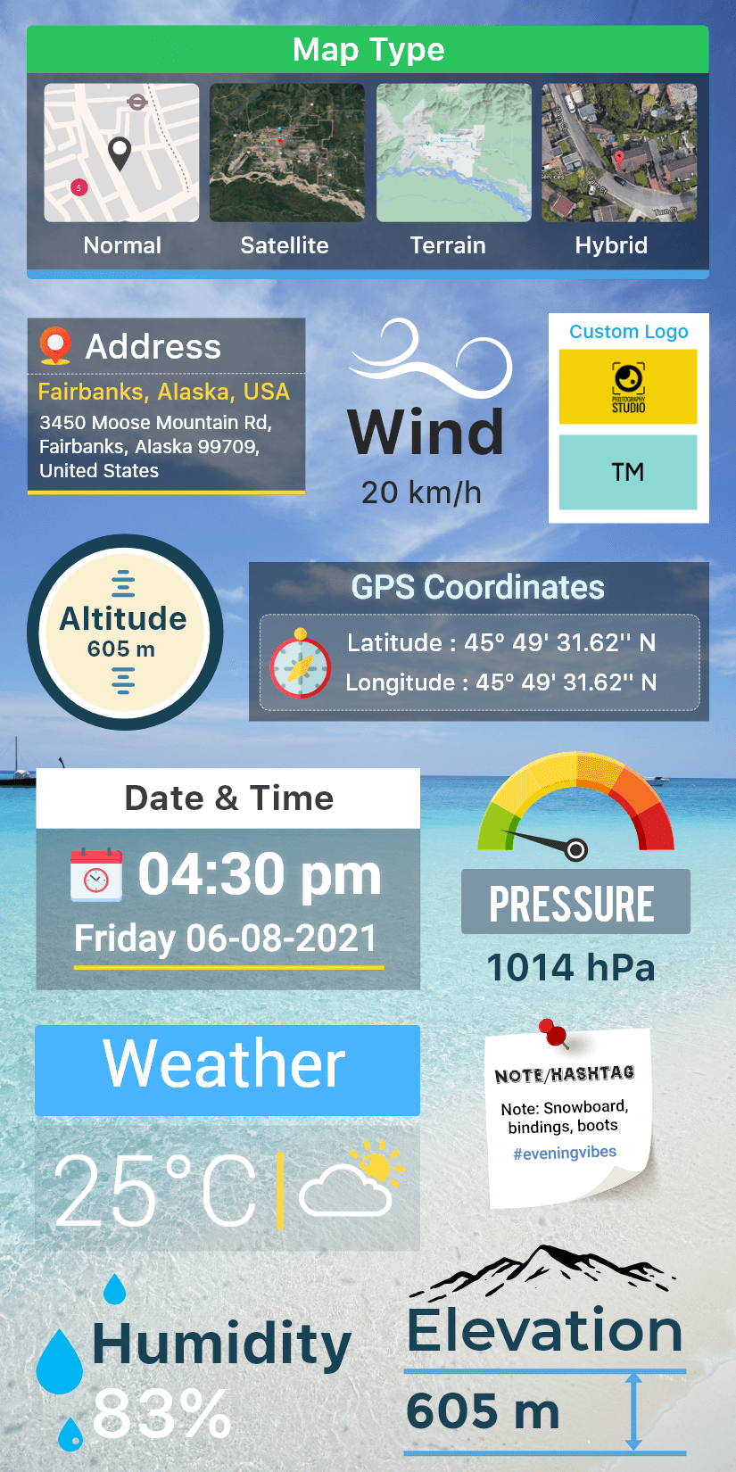
GPS Map Camera is designed as a specialized photography tool that enables the annotation of captured images with a comprehensive suite of geographic and temporal data. When a user takes a picture using a smartphone equipped with this application, the software integrates specific information directly onto the image file. This data includes the precise date and time of the capture, alongside the geographical location and a visual map representation. Furthermore, the application captures and displays technical coordinates such as latitude and longitude, providing an exact point of reference for where the image was produced. Beyond basic location data, the tool also records environmental and directional metrics, including the altitude of the user, current weather conditions at the site, the local magnetic field strength, and compass headings. This functionality is particularly useful for individuals who wish to maintain a detailed record of their travels or specific stops made during a journey, allowing them to revisit those memories with high-precision context and factual data regarding the environment.
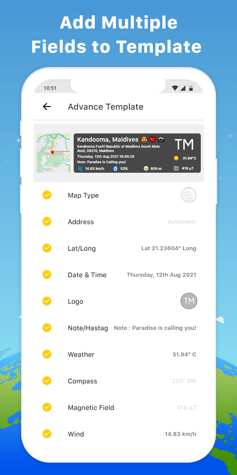
The application provides a structured approach to how these data points are presented on the final photograph through various layout systems. Users have the option to choose between different layout styles, specifically identified as Advanced Templates and Classic Templates. These templates dictate the visual arrangement of the stamp, ensuring that the information is legible and aesthetically integrated with the photo content without obscuring the subject. The software allows for the rearranging of stamp formats, giving users the flexibility to prioritize certain data points over others depending on their specific needs for documentation. By altering the settings within the application, users can fulfill various requirements for GPS map Location Stamps, ensuring that the output matches their professional or personal documentation standards. This customization process is a core component of the user experience, as it allows for the automatic stamping of GPS coordinates onto every photo taken through the interface, serving as the final step in the image creation workflow.
In addition to its data-stamping capabilities, the application functions as a full-featured camera interface with several manual and automatic controls designed for versatile photography. It supports standard photography tools such as a grid overlay for composition and various aspect ratios to suit different display requirements or social media standards. The camera software is compatible with both the rear-facing and front-facing selfie cameras, ensuring that users can document their own presence at a location alongside the geographic data. Integrated features include flash control for low-light environments, manual and automatic focus for clarity, and a mirror mode specifically for the front camera. For more complex shooting scenarios, the app includes a timer function and support for sound recording, allowing for a broader range of media capture beyond simple still images, while maintaining the specialized focus on geotagging and metadata integration.
Mapping functionality within the application is highly adaptable, offering both automatic and manual modes for selecting map data based on the user’s current environment. Users can choose to let the software determine the most relevant map information based on their current GPS signal or manually intervene to select specific data points that they want to highlight. A notable feature is the ability to apply a Satellite Map Stamp directly onto photos, which provides a top-down aerial view of the surroundings rather than a traditional street map. This is particularly effective for outdoor enthusiasts, researchers, or professionals working in remote areas where street maps may not provide sufficient detail. The Classic Template remains a reliable option for those who prefer a more traditional data presentation, automatically retrieving stamp-specific data to be overlaid on the image during the clicking process to ensure the location stamp is accurately placed.
The practical application of GPS Map Camera extends to social sharing and logistical tracking for both personal and professional use. Users can send geo-located photos of specific streets and places they have visited to family and friends, providing a clear visual and geographic record of their travels and the specific locations they have been. The app serves a dual purpose by tracking not only the user’s current real-time location but also the specific locations where individual photos were captured in the past. This creates a chronological and spatial history of a trip or a specific project site. The process of getting started involves acquiring the application and then deciding which configuration—whether Advanced or Classic—best serves the user’s goals for geographic documentation. By integrating latitude, longitude, and altitude directly into the visual record, the application transforms a standard photograph into a data-rich document that conveys the physical context of a moment.
The technical integration of environmental data like the magnetic field and weather conditions adds another layer of depth to the photography experience. These metrics are captured at the exact moment of the shutter press, ensuring that the stamp reflects the actual conditions on the ground at that specific time. The altitude reading is particularly useful for hikers, climbers, or individuals working in mountainous terrain, while the compass and magnetic field data provide orientation details that are often lost in standard photography. By combining these diverse data streams into a single stamp format, the application ensures that all relevant environmental factors are preserved for future reference. Whether using the manual selection for map data or relying on the automated systems, the end result is a photo that serves as a comprehensive record of a specific place and time, complete with the technical specifications required for detailed geotagging and environmental documentation.
Key features
- Date, time, and location stamping
- Latitude, longitude, and altitude data
- Weather, magnetic field, and compass integration
- Advanced and Classic Templates
- Rearranging Stamp Formats
- Grid, ratio, and focus camera tools
- Front and selfie camera support
- Flash, mirror, and timer functions
- Sound recording support
- Satellite Map Stamp on photos
- Manual and automatic map data selection
Related MOD APKs
FAQ
Is Premium unlocked in GPS Map Camera MOD APK?
This 1.9.29 build of GPS Map Camera has Premium Unlocked. It performs like the GPS Map Camera release, and features are active once you finish installing.
What is the latest version of GPS Map Camera MOD APK?
GPS Map Camera version 1.9.29 was released August 15, 2026. We don’t keep older versions here. Update by installing this file over your current one. If you see a signature error, delete the previous version before reinstalling.
Is GPS Map Camera MOD APK safe to download?
This 1.9.29 GPS Map Camera build provides Premium Unlocked. 54 people gave it a 3.5 rating. It does not require root. You might see a Play Protect alert, so always download from this page. This is the GPS Map Camera app with specific modifications.
Does GPS Map Camera MOD APK remove the watermark?
This build has Premium Unlocked. Removing watermarks is a pro feature in GPS Map Camera, so you should check the export screen after installing to verify it works.